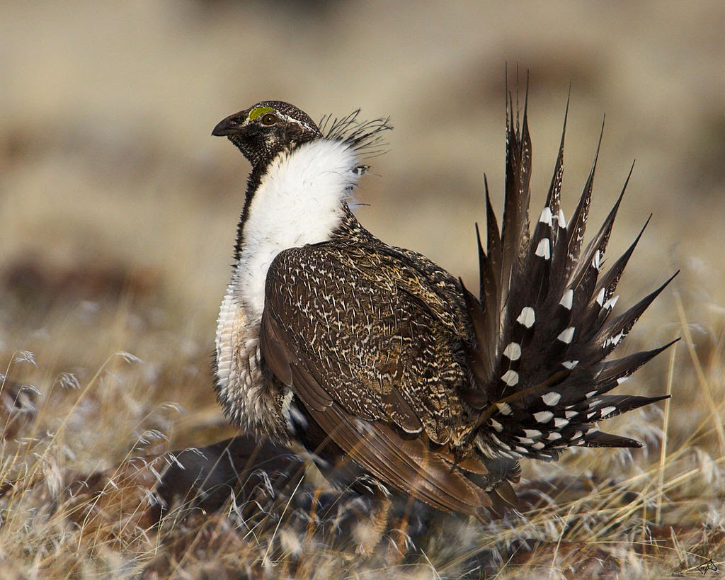
Sage Grouse Conservation without an Endangered Species Act Listing:
Digging into the National Greater Sage Grouse Planning Strategy Records of Decision
By Sarah Liljefelt and Lucy Page Chesnutt, Schroeder Law Offices, PC
Note: this article originally appeared in the Oregon State Bar’s Environmental and Natural Resources Section publication, E-Outlook.
On September 18, 2015, in a coordinated effort, the Bureau of Land Management (BLM) and United States Forest Service (USFS) each issued a Record of Decision (ROD) related to greater sage grouse habitat on lands administered by the BLM and USFS. Together, the BLM and USFS RODs and the plans they implement, serve as the Federal strategy in lieu of listing the greater sage grouse under the Endangered Species Act (ESA). The strategy operates as a complex habitat zoning scheme, which shifts development away from defined key habitat and tightly restricts other habitat classified as less integral to sage grouse survival.
This is a first-of-its-kind approach to conservation on this scale. The impacted areas cover approximately 67 million acres across 68 BLM planning units and 20 National Forests and Grasslands in ten western states.[i] While the agencies report that the RODs will not affect existing rights, it is evident that future development is tightly restricted with regard to activities including mining, renewable energy development, fluid mineral development, oil and gas leases, rights of way, and grazing. Thus, as these plans go into effect, western Governors, businesses, environmental interests, and others are paying attention to the impacts of the RODs on local economies and the environment, with some taking legal action to oppose their implementation.[ii]
Structure
The overarching structure of both the BLM and USFS RODs incorporate tiered habitat zoning mechanisms that offer higher levels of protection in areas with the highest density of sage grouse, and fewer restrictions, but additional habitat restoration requirements, in areas where density is lower. Based on a BLM mapping study of important habitat across the range of the greater sage grouse, areas were classified into categories within the habitat management area (HMA).[iii] Areas with the highest density were designated as Priority Habitat Management Areas (PHMAs).[iv] Areas with lower density were designated as General Habitat Management Areas (GHMAs).[v] Subsets of PHMAs noted to be especially high value habitat were designated as Sagebrush Focal Areas (SFAs).[vi] Idaho has a third category of habitat designated as Important Habitat Management Area (IHMA), while Nevada and Northeastern California have a distinct habitat tier as well, Other Habitat Management Area (OHMA).[vii] The agencies report that variations among regions are intended to provide flexibility in implementing state-specific coordination between federal, state and private entities.
The BLM ROD and its associated Approved Resource Management Plan Amendments (ARMPAs) focus on identifying four key conservation strategies and implementing specific management actions based on the tiered habitat management areas. In contrast, the USFS ROD and its associated Land Use Management Plan Amendments (LMPAs) focus on specific threats to sage grouse habitat and identified responses to those threats based on the tiered habitat management area. Together the RODs, ARMPAs, and LMPAs operate to implement the National Greater Sage Grouse Planning Strategy.[viii] These documents occupy 362 pages of material, and therefore this article attempts to summarize important details within the plans.
Bureau of Land Management Greater Sage Grouse Record of Decision
The BLM ROD and ARMPAs include four strategies:
- Avoiding or Minimizing New and Additional Surface Disturbance
- Improving Habitat Conditions
- Reducing threats of rangeland fire to GRSG and sagebrush habitat in the Great Basin; and
- Monitoring and evaluating the effectiveness of conservation measures and implementing adaptive management, as needed.[ix]
For each strategy, specific management actions are required based on the designated habitat management area, (i.e. SFA, PHMA, or GHMA).
Avoiding or Minimizing New and Additional Surface Disturbance
In order to avoid or minimize new and additional surface disturbance the BLM ROD and ARMPAs restrict actions in all HMAs. The ROD and ARMPAs do this in three key ways. First, they establish “no surface occupancy” requirements with regard to certain activities. Second, they impose disturbance caps. Lastly, they require mitigation for all proposed projects that are allowed in HMAs.
No surface occupancy is imposed in areas identified as SFA and PHMA for certain activities because this habitat has the highest value for sage grouse.[x] The no surface occupancy is imposed on disturbance from fluid mineral development, new mineral leasing, renewable energy development, rights of way, and recreation.[xi] Additionally, in areas designated as SFAs, it is recommended that these lands be withdrawn from mineral entry under the Mining Law of 1872, subject to valid existing rights.[xii] While some exceptions are available in PHMAs for fluid mineral leases, the rules promise to severely limit all new activity permitted in SFAs and PHMAs. In comparison, activities in GHMAs are allowed but limited by surface occupancy and timing limitations, meaning that for oil and gas drilling, these activities must be consolidated to avoid spreading disturbance over large swaths of land, and mining and drilling activities cannot occur during mating season near leks.[xiii]
Disturbance caps are imposed in all HMAs in order to limit disturbance to sage grouse populations and habitat.[xiv] These caps range from 1 percent in Oregon to 5 percent in Montana.[xv] Under these restrictions, if the cap is reached, no new human disturbance activity will be permitted until sage grouse habitat has been restored to bring the area below the disturbance cap.[xvi] Importantly, these caps are subject to valid existing rights, such that those activities that are already permitted or in the process of being permitted should not be affected.[xvii] Nevertheless, some oil and gas interests are concerned about the future availability of leasable land.[xviii] According to Interior Secretary Sally Jewell, ninety percent of the lands with high and medium oil and gas potential are outside of priority habitat areas and will not be affected by the caps.[xix] Thus, while the disturbance caps aim to reduce activities that impair sage grouse numbers and habitat, the agency reports that they will not impact existing rights, and supposedly will not impact areas where there is a high likelihood of oil and gas development potential.
Lastly, mitigation will be required for all proposed projects that are permitted in GHMAs.[xx] The objective of the mitigation must be to avoid and minimize potential impacts to sage grouse populations and habitat.[xxi] This mitigation must result in an overall net conservation gain for the species despite the presence of the newly permitted activity.[xxii] Importantly, compensation for impacts can be used to achieve a net conservation gain.[xxiii] However, the combination of mitigation project costs as well as compensation may prove to be costly for newly permitted activities.
Improving Habitat Conditions
In order to improve habitat conditions for the sage grouse, new habitat protection and disturbance measures will be imposed that require buffers around leks when activities are permitted, and management actions to improve current habitat conditions will be prioritized.[xxiv]
Lek buffers will be applied at a project-specific level as identified in a National Environmental Policy Act (NEPA) analysis.[xxv] For example, if a new activity is permitted on BLM land it must undergo a NEPA analysis. The ROD and ARMPAs require that as part of that NEPA analysis, lekking areas must be identified and buffers must be established in relation to the type of activity being permitted.[xxvi] Some activities such as mining, right of way projects and energy development will also require “required design features,” these design features are specific to a project in order to help mitigate adverse impacts on sage grouse and habitat.[xxvii]
Actions to improve habitat conditions focus on improving all lands ecologically capable of producing sagebrush.[xxviii] In order to achieve this, improvements are to be prioritized in areas most likely to have the most impact on sage grouse populations and habitat.[xxix] Specific activities involve treating invasive annual grasses and removing encroaching conifers, restoring degraded landscapes, reviewing grazing authorizations and field checking grazing permits, adjusting management levels for wild horses and burros, and building resilience in the sagebrush steppe to climate change impacts.[xxx]
The BLM expresses the overall goal of maintaining all lands ecologically capable of producing sagebrush with a minimum of 15 percent sagebrush canopy cover by using lek buffers, required design features, and taking active steps to improve areas that are most likely to improve sage grouse populations and habitat.[xxxi] The largest impact of these actions may be in the manner the grazing authorization and field checks occur, which at this time is uncertain. The BLM has vowed to faze the restrictions in over time.[xxxii]
Reducing Threats of Rangeland Fire to Greater Sage Grouse and Sagebrush Habitat
Rangeland fire in the sagebrush-steppe has been identified as one of the primary risks to the sage grouse, especially as part of the positive feedback loop between exotic invasive grasses and fire frequency.[xxxiii] Thus, the ROD and ARMPAs include strategies to develop fuel breaks, accelerate restoration of fire-impacted landscapes, and fight the spread of invasive species.[xxxiv] Resources will be targeted by using fuel treatments, fire suppression and restoring habitat.[xxxv] The ARMPAs attempt to combat rangeland fire and reduce threats to habitat, but many have criticized that the reduction in grazing will ultimately cause more rangeland fires.
Monitoring, Evaluation and Adaptive Management
The final tenet of the BLM ROD conservation strategy involves implementing monitoring and adaptive management in order to track successes and management activities.[xxxvi]
The framework has two major components. First, it provides for implementation monitoring.[xxxvii] This requires monitoring whether decisions are being implemented in a timely manner and if actions taken are consistent with plan decisions. Second, the framework provides for effectiveness monitoring.[xxxviii] This requires monitoring whether the decisions and implementing actions are achieving their desired effects. Through these monitoring techniques, the goal is to provide information to evaluate whether the overarching conservation strategy goals are being met.
The framework provides for adaptive management by establishing hard and soft triggers and responses.[xxxix] These triggers are based on two key metrics being monitored: habitat conditions and population numbers.[xl] If soft triggers are met, an intermediate threshold has been breached indicating that management changes are needed to address habitat or population losses. If these are triggered, BLM will implement more restrictive conservation measures on a project by project basis. A soft trigger will begin with a dialogue between the State, the United States Fish and Wildlife Service (USFWS) and BLM to determine the cause and determine the best course of action to reverse the trend.[xli] If hard triggers are met, BLM will implement plan-level decisions to immediately institute greater protection for sage grouse and its habitat without the same level of dialogue.[xlii]
United States Forest Service’s Greater Sage Grouse Record of Decision
The USFS ROD approves the four Great Basin region sub-regional Land Use Management Plan Amendments (LMPAs) to the existing land use management plans for Forest Service land in Idaho, Southwest Montana, Nevada, Utah and Wyoming.[xliii] In comparison to the BLM ROD, the USFS ROD identifies how to address specific threats to the greater sage grouse. Nevertheless, many of the same implementing actions are prevalent in both the USFS and BLM RODs.[xliv]
Threats and Responses
Habitat Conversion to Agriculture and Urbanization
Lands classified as PHMA or GHMA will be retained in Federal management unless the agency demonstrates disposing of land will result in a net conservation gain or the land disposal will have no adverse impacts on the conservation of sage grouse.[xlv]
Infrastructure and Renewable Energy Development
Development such as roads, pipelines, power lines and cellular towers will generally not be authorized in HMAs. However, if development is authorized, adverse impacts associated with development must be mitigated with habitat protection or restoration activities that will produce a net conservation gain.[xlvi] While PHMAs have the most restrictive activity allowances, essentially prohibiting development, GHMAs are less stringent and infrastructure is allowed within existing designated corridors.[xlvii] The agency avows that authorized rights of way will not be affected or subject to these restrictions.[xlviii] Renewable energy developments will generally not be authorized in PHMAs.[xlix] However, renewable energy development may be allowed in GHMAs, but will be subject to certain stipulations to protect sage grouse and its habitat.[l]
Fire, Invasive Species and Conifer Encroachment
The LMPAs focus on implementing strategies to prevent, suppress, and restore landscapes identified as priorities in the fire and invasive species assessment.[li] They operate by focusing on establishing 10 to 30 percent sagebrush canopy cover on 70 percent or more of lands capable of producing sagebrush.[lii] When treating areas, fire and fuels projects will focus on retention of sagebrush dominated communities and restoration projects will focus on sagebrush communities where site conditions and management actions favor speedy recovery.[liii] Lastly, rehabilitation projects will focus on recovery of post-fire sagebrush communities where sagebrush has been replaced by annual grasslands.[liv]
Grazing
Livestock grazing will be managed to achieve or maintain agency-determined desired conditions for sage grouse habitat, including maintaining residual perennial grass height to provide for adequate sage grouse nesting cover in order to increase the likelihood of nesting, brooding and rearing.[lv] This means that grass height must be maintained for overhead and lateral concealment during nesting and early brood rearing.[lvi] These values may vary depending on the area and the type of cover available. Additionally, grazing and sheep camps will be required to maintain a specified distance from leks during mating season.[lvii] The Forest Service has assured ranchers that they should not expect drastic changes, however, these requirements seem quite extreme.[lviii] Again, the of the agency states that the LMPAs will be phased in over time.[lix]
Energy Development and Mining
Like the BLM ROD, in the LMPAs all HMAs will be restricted with regard to new energy development and mining. For example, PHMAs will be managed as no surface occupancy with regard to fluid mineral development and new oil and gas leases.[lx] Additionally, in GHMAs, leks are protected through controlled surface use and timing limitation stipulations in order to ensure habitat is protected during mating season.[lxi] Lastly, locatable minerals in SFAs are recommended to be withdrawn under the Mining Lct of 1872.[lxii] While valid, existing rights are not supposed to be affected, the new rules promise to restrict new development with regard to energy development and mining significantly. Thus, individuals planning to move forward with proposed projects will need to be cognizant of HMA boundaries and the impact of proposed activities on sage grouse when approaching the USFS about new development.
Monitoring, Mitigation and Adaptive Management
The USFS ROD incorporates the same monitoring framework as the BLM monitoring framework. It focuses on implementation and effectiveness monitoring in order to assess actions and track sage grouse populations and habitat attributes.[lxiii] Following the same framework as the BLM, the LMPAs incorporate the same soft and hard triggers indicating thresholds have been breached and management changes are necessary.[lxiv] Lastly, when authorizing new land uses that result in habitat loss or degradation the USFS will require mitigation that provides a net conservation gain to sage grouse.[lxv]
Disturbance Caps
Like the BLM ROD, the USFS ROD LMPAs impose disturbance caps which range from 3 to 5 percent across the Great Basin.[lxvi] If the cap is exceeded on lands within a PHMA, no further human disturbances (subject to existing rights) will be permitted until the disturbance can be brought below the cap.[lxvii] Similar exceptions as in the BLM ROD apply to the USFS ROD such as allowing future right of way development in areas of existing disturbance.[lxviii]
Analysis of Changes
The most challenging question for those impacted by these new LMPAs and ARMPAs is: What does it mean? To this end, the most appropriate answer is, it depends. In much of the Great Basin, while projects proposals have been constrained by NEPA processes to date, these new management directives restrict a large amount of land designated as SFA to little or no development in the form of no surface occupancy limitations. Additionally, the recommendation to foreclose development of minerals under the Mining Law of 1872 from being mined in SFAs could prove to be fatal to some proposed mining projects.[lxix]
The impact of designating management areas as avoidance areas for infrastructure and major rights of way with certain stipulations may prove to be especially challenging. This is because creating net conservation gains across the length of large transmission right of way project includes accounting for a variety of habitat types and connectivity habitat along the entire length of a project. As these projects are often large in scope and impact, ultimately creating a net conservation gain for the species may prove to be a formidable challenge.
Lastly, ranchers utilizing USFS lands will be required to ensure residual perennial grass height to provide for adequate sage grouse nesting cover to increase the likelihood of nests. Although there some USDA funding available to help facilitate remediation of grazed areas, and the USFS promises to phase in the restrictions over a period of time, conflict will inevitably result from the additional restrictions. Additionally, leaving grass height higher means leaving more “fuel” on public land that may contribute to more frequent and more severe wildfires.
Comparison to Listing
The BLM and USFS RODs were issued in lieu of listing sage grouse as a threatened or endangered species. If a species is listed under the ESA, a series of restrictions are triggered to protect the species.[lxx] These include protection from being “jeopardized” by federal activities, protection of “critical habitat” from being destroyed or adversely modified, restrictions on “take” and trade, a requirement that the USFWS develop and implement recovery plans, authorization to seek land purchases or exchanges for important habitats, and federal aid for creating cooperative agreements, and more.[lxxi]
If the sage grouse had been listed in this instance, Section 4 of the ESA would require that all federal agencies seek to conserve that species and use their authority to carry out conservation programs to that end.[lxxii] It would also require that the agency ensure any actions that it carries out (such as permitting, licensing or leasing) not jeopardize the survival of the species or destroy or adversely modify its designated critical habitat.[lxxiii] Similarly, if the sage grouse had been listed, Section 9 of the ESA would also apply. Under section 9 it is illegal to take, import, export or engage in interstate or international commerce in listed animals except by permit for certain conservation purposes.[lxxiv] These limitations, although they can be avoided through issuance of incidental take permits, often halt activities that would otherwise occur in an area, without regard to existing rights, until the species can recover.
However, it is unclear at this time whether the RODs will be less restrictive than allowable activities under the ESA if sage grouse had been listed. After many years of voluntary effort to conserve the species, many parties feel as though the RODs may be worse than the ESA listing they were cooperatively seeking to avoid.
Judicial Challenges to ARMPAs and LMPAs
The RODs were not introduced without criticism from environmentalists, local governments and industry. Currently, the Governor of Idaho, along with the Idaho Legislature have challenged the implementation of the ARMPAs and LMPAs in court.[lxxv] Additionally, the Nevada Attorney General joined a suit filed by Elko and Eureka Counties and mining companies in Nevada challenging the new land use restrictions.[lxxvi]
The Idaho suit challenges the USFS and BLM rules, stating that the plans illegally restrict resource development and grazing, alleging that the imposition of a fourth tier of HMAs, the SFAs, as well as the imposition of lek buffers and net conservation gain mitigation standards were not analyzed in the Idaho draft environmental impact statements.[lxxvii] Additionally, the complaint alleges that the federal government violated the law by failing to complete the federal planning process in an open and transparent manner.[lxxviii] The Nevada lawsuit also claims the restrictions on development were adopted illegally and would threaten mining, ranching and rural economies across much of the West.[lxxix]
These legal challenges are just in their infancy, but a first decision by a federal judge in Nevada related to the sage grouse litigation on Tuesday, December 8th, 2015 denied injunction preventing the implementation of the LMPAs because the petitioners failed to prove that any irreparable harm could be averted by immediately halting implementation of the regulations.[lxxx] The Judge found that the claims raised only the possibility, not a likelihood of irreparable harm.[lxxxi] Additionally, witnesses for the counties and ranchers conceded that the amendments do not modify existing permits or rights as explicitly stated in both the ARMPAs and LMPAs.[lxxxii] Thus, as the case proceeds, evidence of irreparable harm as a result of plan implementation will be a central issue.
Meanwhile, environmental groups have criticized the plans for not doing enough to protect sage grouse.[lxxxiii] These groups allege that since there is not a specific timeline for implementation it will be easy for agencies to rubber stamp current practices.[lxxxiv] Nevertheless, as these cases proceed through the courts, and as the land use plans are implemented on the ground, it will just be a matter of time to see how the sage grouse, its habitat, and those that depend on land in the West for their livelihoods continue to negotiate use of the resources.
Conclusions
The purpose of the RODs implementing the ARMPAs and LMPAs in the Great Basin Region is to maintain sage grouse habitat and populations and help ensure continued stability and growth for the population. While avoiding a listing under the ESA, which would have forbidden jeopardizing the continued existence of the species and specific take of the bird, the RODs restrict development in ways that may not have been restricted if sage grouse had been listed. As such, the ultimate impact of the RODs will be in the way they are administered on the ground and how communities respond to the effects on the environment, industry, and local economies.
[i] United States Department of the Interior Bureau of Land Management (BLM): Record of Decision (ROD) and Approved Resource Management Plan Amendments (ARMPAs) for the Great Basin Region, Including Greater Sage-Grouse (GRSG) Sub-Regions, p. 1-33, September 2015; See also, BLM Website, “Frequently Asked Questions About the Greater Sage-Grouse,” available at: http://www.blm.gov/wo/st/en/prog/more/sagegrouse/frequently_asked_questions.html#today (last visited January 25, 2016).
[ii] This review is not intended to be wholly comprehensive, but rather an overview of the major requirements and potential impacts to individuals in areas affected by the plans.
[iii] See Breeding Densities of Greater Sage-Grouse: A Tool for Range-Wide Conservation Planning: September 24, 2010, available at http://www.blm.gov/style/medialib/blm/wo/Planning_and_Renewable_Resources/fish__wildlife_and/sage-grouse.Par.99075.File.dat/gsgr_rangewide%20_breeding_density.pdf
[iv] BLM ROD and ARMPAs for Great Basin GRSG Sub-Regions, p. 1-7 and 1-14, September 2015.
[v] BLM ROD and ARMPAs for Great Basin GRSG Sub-Regions, p. 1-14, September, 2015.
[vi] Id. at p. 1-15.
[vii] Id. at p. 1-14 to 1-15.
[viii] United States Forest Service Record of Decision and Land Use Plan Amendments for Greater Sage Grouse in Idaho and Southwest Montana, Nevada and Utah, p. 12, September, 2015.
[ix]BLM ROD and ARMPAs for Great Basin GRSG Sub-Regions, p. 1-20, September, 2015.
[x] Id. at 1-20 to 1-21.
[xi] Id.
[xii] Id. at 1-20.
[xiii] Id. at 1-23 to 1-24. A “lek” is an aggregation of males that gather to engage in competitive displays in order to entice females to mate. Lekking typically occurs in areas of bare soil and short-grass steppe that is surrounded by denser cover. See Beginner’s Guide to Greater Sage Grouse available at: http://www.fws.gov/greatersagegrouse/factsheets/Primer1-SGBeginnersGuide.pdf.
[xiv] Id. at 1-21 to 1-22.
[xv] Id.
[xvi] Id.
[xvii]Id.
[xviii] S. Streater, Endangered Species: Hard Questions Presage Challenges to Federal Grouse Plans, E & E Publishing, LLC, June 16, 2015, available at: http://www.eenews.net/stories/1060020312.
[xix] Id.
[xx] BLM ROD and ARMPAs for Great Basin GRSG Sub-Regions, p. 1-22-1-23, September, 2015.
[xxi] Id.
[xxii] Id. at 1-23 to 1-24.
[xxiii] Id.
[xxiv] Id.
[xxv] Id.
[xxvi] Id.
[xxvii] Id.
[xxviii] Id. at 1-24.
[xxix] Id. at 1-24 to 1-25.
[xxx] Id.
[xxxi] Id. at 1-24.
[xxxii] S. Streater, Endangered Species: Hard Questions Presage Challenges to Federal Grouse Plans, E & E Publishing, LLC, June 16, 2015, available at: http://www.eenews.net/stories/1060020312.
[xxxiii] BLM ROD and ARMPAs for Great Basin GRSG Sub-Regions, p. 1-26, September, 2015.
[xxxiv] Id. at 1-26 to 1-27
[xxxv] Id. at 1-28
[xxxvi] Id.
[xxxvii] Id.
[xxxviii] Id.
[xxxix] Id. at 1-29.
[xl] Id.
[xli] Id.
[xlii] Id.
[xliii] United States Forest Service Record of Decision and Land Use Plan Amendments for Greater Sage Grouse in Idaho and Southwest Montana, Nevada and Utah, p. 15, September, 2015.
[xliv] Id. at 12.
[xlv] Id. at 27.
[xlvi] Id. at 27 to 28.
[xlvii] Id. at 27 to 28, 51.
[xlviii] Id. at 23, 64.
[xlix] Id. at 29, 50.
[l] Id. at 50.
[li] Id. at 29 to 30.
[lii] Id. at 30.
[liii] Id.
[liv] Id.
[lv] Id. at 31.
[lvi] Id.
[lvii] Id.
[lviii] S. Streater, Endangered Species: Hard Questions Presage Challenges to Federal Grouse Plans, E & E Publishing, LLC, June 16, 2015, available at: http://www.eenews.net/stories/1060020312.
[lix] Id.
[lx] United States Forest Service Record of Decision and Land Use Plan Amendments for Greater Sage Grouse in Idaho and Southwest Montana, Nevada and Utah, p. 32 to 33, September, 2015.
[lxi] Id. at 33.
[lxii] Id. at 34.
[lxiii] Id. at 36.
[lxiv] Id. at 37.
[lxv] Id.
[lxvi] Id. at 39.
[lxvii] Id.
[lxviii] Id. at 39-40.
[lxix] The BLM is currently conducting Public Scoping Meetings on Proposed Mineral Withdrawal in Sagebrush Focal Areas and has extended the comment period under the withdrawal proposal until January 15, 2016, see http://www.blm.gov/wo/st/en/prog/more/sagegrouse/public_meetings.html.
[lxx] See generally Endangered Species Act of 1973, 16 U.S.C. § 1531 et seq.
[lxxi] Id.
[lxxii] Endangered Species Act of 1973, 16 U.S.C. § 1533.
[lxxiii] Endangered Species Act of 1973, 16 U.S.C. § 1536.
[lxxiv] Endangered Species Act of 1973, 16 U.S.C. § 1538.
[lxxv] State of Idaho, Office of Governor C.L. “Butch” Otter: Press release September 25, 2015, available at: http://www.gov.idaho.gov/mediacenter/press/pr2015/2%20Feb/pr_61.html.
[lxxvi] State of Nevada, Office of Attorney General Adam Paul Laxalt: Press Release October 22, 2015, available at: http://ag.nv.gov/News/PR/2015/Attorney_General_Laxalt_Issues_Statement_Confirming_the_Support_of_Nevada_Counties_in_Sage-Grouse_Lawsuit/.
[lxxviii] Id.
[lxxix] State of Nevada, Office of Attorney General Adam Paul Laxalt: Press Release October 22, 2015, available at: http://ag.nv.gov/News/PR/2015/Attorney_General_Laxalt_Issues_Statement_Confirming_the_Support_of_Nevada_Counties_in_Sage-Grouse_Lawsuit/; see also Elko Daily Newspaper: http://elkodaily.com/mining/elko-others-sue-to-stop-sage-grouse-restrictions/article_e1677c75-78d6-5ba0-a935-937e5029a0b7.html. (September 26, 2015).
[lxxx] Scott Sonner, Nevada Judge Denies Counties’ Bid for Sage Grouse Injunction, Associated Press, December 9, 2015, available at http://bigstory.ap.org/article/c5dd70b9e71b411d8640f40ac6aaa46c/nevada-judge-denies-counties-bid-sage-grouse-injunction.
[lxxxi] Id.
[lxxxii] Id.
[lxxxiii] G. Moore, Sage Grouse Plans Criticized from Both Sides, Idaho Mountain Express, September 30, 2015, available at http://www.mtexpress.com/news/environment/sage-grouse-plan-criticized-from-both-sides/article_5100a1ae-6706-11e5-8385-2f55922c5b0a.html; see also Nathan Rott, Lawsuits Will Be Next Battle in Sage Grouse Conservation Saga, NPR News, September 23, 2015, available at http://www.npr.org/2015/09/23/442761559/court-challenges-will-be-next-battle-in-sage-grouse-conservation-saga.
[lxxxiv] Id.