Land Use in the United States

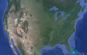
On July 31, 2018, Bloomberg released an interactive series of maps demonstrating the breakdown of land use in the United States. The article, which can be found here, provides an in-depth look at the ways in which we utilize the nearly 2 billion acres of land in the contiguous United States.
 The United States is a huge country, ranking third in the world in both land mass and population. However, the vast majority remains uninhabited. Only around 70 million cumulative acres are considered “urban” land. Another 50 million-or-so acres qualify as “rural residential” land. So, what do we do with the remaining 94%? First and foremost, we farm.
Between pasture, rangeland, and cropland, over half of America’s total acreage is used for agriculture. As shown in the Bloomberg maps, if all the grazing land in the United States were laid out side-by-side, it would cover nearly all of the western states. Additionally, over 391 million acres throughout the country are used for growing commercial and consumable crops.
It is unsurprising, then, that the United States Department of Agriculture (“USDA”) estimates that over 80% of water in the US is used for agricultural purposes. When the proportion of agricultural land is compared to the proportion of agricultural water, the ratio makes sense.
The Bloomberg maps offer a fascinating breakdown of the way our country as a whole makes use of its space and, by extension, its water. Stay tuned to Schroeder Law Offices’ blog for more water use facts!