Oregon Extensions of Time Receive Increased Scrutiny

Do you remember when extensions of time were approved by the Oregon Water Resources Department routinely with ease? That time was over for municipal water providers years ago (see related article); however, until recently, other permit holders simply faced increasing amounts of application paperwork.  Now, that time may be over for every permit holder. Our office has seen requests for extensions of time receive increased scrutiny from the Department as of late.

Recently, a client applied for their first extension of time after investing substantial resources towards diligent development under their water use permit. The proposed final order approving the extension of time was 13 pages long, discussing every single inquiry from the extension application and whether the client’s response was sufficient. Even though the Department is proposing approval, it is clear that such approval will be more difficult to receive going forward.

Certain factors are of extreme importance for water users hoping to obtain extensions of time for their water use permits. Physical construction must begin and be diligently prosecuted during the time to complete construction under the permit or prior extension period. The Department will closely examine how much physical development of the water system has occurred and the permitee’s reasons for not completing construction. The Department will also evaluate and balance financial investment, market and present demands for water, the amount of water available to satisfy other affected water use rights, scenic waterway flows, and habitat needs of sensitive, threatened or endangered species.

Of additional importance is compliance with permit conditions. If a groundwater use permit requires annual static water level measurements following well construction, it is extremely important that the permittee complies with the condition. The same is true for installation of flow meters, submission of water use reports, and more. The Department may deny an application for extension of time for less than full compliance with all permit terms.

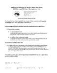
Applications for extensions of time have increased in length and complexity over the years. The current permit extension application is 12 pages long. (Extension of time application forms are available here.) Our office routinely completes extension of time applications for clients. It takes time to provide all the development details and documentation now required by the Department. Do not wait until the day before your permit expires to start your extension application. We recommend seeking assistance one year before your permit or current extension term expires to consider if an extension can be avoided, and, if not, making sure all conditions are met before an extension of time application is filed.

It is more important now than ever to make sure you have all your “ducks in a row” when using water under a permit and seeking an extension of time. Stay tuned to Schroeder Law Office’s Water Law Blog for more news that may affect you!


Oroville Dam Rebuild

In February 2017, the town of Oroville, California was in for quite the surprise! Butte County Sherriff’s Office issued a mandatory evacuation notice as the full reservoir (Oroville Lake) above Oroville threatened to wash out residents. The reservoir’s dam spillways were severely damaged by increased water flow caused by the seemingly unceasing rains. Now the question is when will it be fixed, and what happens next?

Many residents have noticed the hustle and bustle of workers and heavy machinery at the Oroville Dam and are wondering what is actually going on.  Rumors abound. According to the San Francisco Chronicle, some say the work must be a secret effort to mine undiscovered gold, or some suspect a missile is taking shape…not a new spillway. Regardless of what the rumor mill might be stirring, one question is on everyone’s mind – Will it be done in time for the winter and spring rains in 2018?

Officials say that they want the spillways to be operational by November 1st, 2017 in case the lake fills up by then. Final touches, on the other hand, will have to wait until next summer. Some residents fear that the work is only a patch job and not a permanent fix, and skeptics are not going to wait around to be proven right or wrong.

One thing is for sure, the California Department of Water Resources is required to make sure that the dam is safe before it is fully operational. Arguably, residents should receive assurance of that the dam is safe before the 2018 rains hit and the lake fills up.

In the meantime, assignment of blame for the 2017 disaster continues. State officials are investigating the spillways and looking into the possibility that poor management is to blame for their damage. One official says that he expects the team’s findings to have implications for other dams in California, and beyond.


Nevada Sets Deadline to File Vested Water Claims! New Legislative Act sets December 31, 2027 Deadline to File All Proof of Appropriations

The state of Nevada began regulating water use through the enactment of the water code in 1905.  Under the 1905 water code, statutory regulation for surface water began.  Later, in 1913 statutes came into play for artesian groundwater rights of use, and in 1939 we see statutes for percolating groundwater rights use. Water rights established prior to those dates are known as “vested water rights” or “vested water claims”.

In order to determine the extent and validity to a vested water use claim, the Nevada State Engineer follows an adjudication procedure outlined in Nevada Revised Statutes wherein the State Engineer issues a Notice of Order for Taking Proofs. This Notice alerts the public that the office of the State Engineer is preparing to review and analyze all claims to vested water rights and determine the validity and extent of each claim. The State Engineer provides a deadline for claimants to file their proofs of appropriation for that basin that is being adjudicated. The State Engineer then carefully considers each claim, with its supporting documentation, and makes a determination of each and every claim to a vested right in that basin.

Historically, there were no deadlines to file a proof of appropriation to claim a vested right to use water until the State Engineer began adjudicating specific basins. While many groundwater basins and surface water systems are adjudicated, there are many that have yet to undergo the process.  Prior to the 79th Nevada Legislative Session, it was not until the State Engineer issued a Notice of Order for Taking Proofs to Determine Water Rights wherein a deadline to file Proofs of Appropriation was set. Senate Bill 270 has amended the statute to set a deadline of December 31, 2027 for any and all proofs of appropriation to be filed in any basin, whether or not an adjudication has been ordered for that basin. The newly revised statute reads “If a claimant fails to file such proof on or before December 31, 2027, the claim shall be deemed to be abandoned.” To read the full text, please visit https://www.leg.state.nv.us/Session/79th2017/Bills/SB/SB270_EN.pdf.

The State Engineer will be required to provide notice of the new deadline in the Newspaper of every groundwater basin in the state and online, and the deadline is still 10 years away. However, after this date no proofs of appropriation will be accepted by the State Engineer, with the only exception of Federal agencies claiming reserved rights. Anyone who believes they may have a claim to a vested right will need to keep this very important deadline in mind. For more information on what is required to support your proof of appropriation, go to https://www.leg.state.nv.us/NRS/NRS-533.html#NRS533Sec115 or http://www.water-law.com/water-rights-articles/nevada-water-rights/.


Conjunctive Management of the Humboldt River Basin and Effects on Small Businesses

The State Engineer held informational meetings on July 17 through July 20, 2017 regarding its Preliminary Draft Humboldt River Conjunctive Management Regulations. The State Engineer is proceeding through administrative rulemaking process to define how Humboldt River Decreed water rights and groundwater rights will be conjunctively managed. If you were unable to attend the informational meetings, you can view the power point used during these meetings by visiting http://water.nv.gov/HumboldtRiver/Humboldt_regs_Small_Business_July_2017.pdf.

As a brief history, the Humboldt River was adjudicated in the 1930’s and large scale groundwater development began approximately 20 years later. Existing studies support the assertion that groundwater pumping is depleting surface river flows. The groundwater basins surrounding the Humboldt River are over-appropriated as the amount of water withdrawals allotted by water rights exceed the perennial yield. As an alternative to curtailing water, the State Engineer is considering Conjunctive Management Regulations. The main objectives of these regulations are to maximize beneficial use of our limited water supply, allow for continued and uninterrupted groundwater use and provide mitigation to senior Decreed water right holders for conflicts of their delivery of surface water. These regulations aim to allow for replacement of injurious depletions to the senior surface right holders, and if replacement water is not available, to require groundwater users to participate in a basin-wide mitigation plan providing mitigation by financial compensation.

At this stage in the rule making process, the State Engineer is attempting to determine if the regulations are likely to place an economic burden on small businesses, and if so, to determine the extent of the impact. Small businesses can submit economic impact statements to the State Engineer for consideration. There are no current deadlines imposed by NDWR for submission of small business impact statements or comments to statements, however, it is likely that we will see some movement within as little as 30 days.


Conjunctive Water Management Planning Underway in the Humboldt River Basin

The Nevada State Engineer is working on a plan to define how to conjunctively manage Humboldt River Decreed water rights hydrologically connected with groundwater rights. This plan will take form through an administrative rulemaking process and will affect many water right holders in and around the Humboldt River Corridor. Nevada Farm Bureau is assisting the State Engineer in setting up informational meetings to discuss concepts in forming the regulatory plan and to obtain feedback on the plan’s economic impacts to small business, farms and ranches.

Currently the United States Geological Survey (“USGS”) and the Desert Research Institute (“DRI”) have a four-year study in the 34 groundwater basins that adjoin the Humboldt River Corridor. The results from the study will determine which individual groundwater wells are hydrologically connected to the surface water flows of the Humboldt River, and to what extent their connection impacts surface flows. Armed with this information, the Conjunctive Management Plan aims to apply annual financial assessments to be paid by each injurious groundwater well in an attempt to recompense senior surface water right owners for their loss of water.

The State Engineer’s preliminary draft regulations for conjunctive management identify the purpose of the regulations as a means to establish rules for a Mitigation Program for the Humboldt River and tributaries identified in the Humboldt River Decree and hydrologically connected groundwater. The plan will establish rules for mitigating conflicts through water replacement or other mitigation measures. The plan will identify water rights of use that are subject to or exempt from plan regulation. The draft regulations identify affected parties as any holder of water rights under the Humboldt River Decree, groundwater right holders whose pumping is determined to capture at least one percent of any Humboldt River Decreed water right, and mining projects whose mine pit lakes capture at least one percent of any decreed surface right and holders of storage water in Rye Patch Reservoir.

The preliminary draft regulations state that the percentage of capture will be initially determined by the USGS/DRI study and thereafter by any further study found suitable by the State Engineer. The State Engineer will determine the amount of conflict to each surface water right and the amount of injurious depletion by groundwater rights, measured in acre-feet, for use in establishing and enforcing the Mitigation Program. The Mitigation Program will be mandatory for all groundwater users determined to be injurious to senior surface water right users. Administration of the program will be funded through existing groundwater and surface water assessments, and the program itself will be funded by groundwater right holders or responsible parties of mining projects, based on their injurious depletions.

The preliminary draft regulations offer regulated groundwater users an alternative to the Mitigation Program by working with the State Engineer to obtain an approved water replacement plan or other type of mitigation plan. If a groundwater right holder fails to participate in the Mitigation Program or have an alternative mitigation plan approved by the State Engineer, that water right holder will be prohibited from diverting any groundwater until the injurious depletion is mitigated and may be subject to penalties and fines.

If you would like to learn more about the draft Regulations for the Conjunctive Management of the Humboldt River Basin, or would like to offer feedback concerning potential economic impacts imposed by the regulations or Mitigation Plan to small businesses, you are encouraged to attend one of the following informational meetings.

Monday, July 17, 2017: 6:30 PM at the Lovelock Community Center in Lovelock Nevada;
Tuesday, July 18, 2017: 6:30 PM at the Humboldt County Cooperative Extension Office in Winnemucca Nevada;
Wednesday, July 19, 2017: 6:30 PM at the Battle Mountain Civic Center in Battle Mountain Nevada; and
Thursday, July 20, 2017: 6:30 PM at the Elko County Conference Center in Elko Nevada.


Walla Walla Subbasin Closed to New Groundwater Permits

The Oregon Water Resources Department (“OWRD”) issued amended rules designating the Walla Walla subbasin as a Serious Water Management Problem Area (“SWMPA”).[1] The amended rules, filed on May 22, 2017, specify new groundwater permits will not be issued in the SWMPA and new groundwater uses will only be allowed for the statutorily exempt uses outlined in Oregon Revised Statutes (“ORS”) 537.545.[2] Some of the statutorily exempt uses for which groundwater may be used, as outlined in ORS 537.545, include stockwatering purposes, watering a one-half acre lawn or noncommercial garden, single or group domestic purposes not exceeding 15,000 gallons per day, or a commercial purpose in an amount not exceeding 5,000 gallons a day.

The SWMPA designation applies to the areas shown on the map accompanying the revised Oregon Administrative Rules (“OAR”).[3] Any already existing groundwater well that is drilled into the basalt and develops groundwater from the Columbia River Basalt Group will be required to install a totalizing flow meter on their well by January 1, 2019.[4] The totalizing flow meter measures and displays both the instantaneous flow rate of groundwater produced from the well and the total volume of groundwater produced from the well. The water right holder, well owner, or well operator will also be required to keep a complete record of the volume of water appropriated each month and submit an annual report of those water use measurements to OWRD.

OWRD implemented the new rules because it has tracked that groundwater levels have dropped by up to four feet per year in the deeper basalt aquifer and by about 100 feet over the past 80 years in the deeper basalt aquifer. The stated policy behind the new rules is to attempt to prevent the declining groundwater levels from growing worse and to ensure enough water is available for senior water use right holders. While some drillers and water users have concerns that OWRD did not consider the possibility that additional water is available in deeper basalt levels, some water use right holders have stated they are glad OWRD is taking steps to protect the resource.[5]

An additional concern was that the Walla Walla Subbasin spans the border between Oregon and Washington and that any action taken by Oregon water users to preserve the resource could be undermined by Washington; however, the two states advise that they have been working together to ensure neither state’s water usage undermines the water savings of the other state. OWRD also plans to work with the local community in the Milton-Freewater area to implement a voluntary, long-term water plan.

This is the first SWMPA established in Oregon.

[1] Or. Admin. R. 690-507-0030.

[2] Or. Admin. R. 690-507-0030(3).

[3] Or. Admin. R. 690-507-0030, Exhibit Map 507-1, available at http://www.oregon.gov/owrd/LAW/docs/law/690_507_Exhibitmaps_2017_May_22.pdf.

[4] Or. Admin. R. 690-5070-0030(4).

[5] Mateusz Perkowski, New Agricultural Wells Prohibited in Oregon’s Walla Walla Subbasin, East Oregonian (May 18, 2017) http://www.eastoregonian.com/eo/local-news/20170518/new-agricultural-wells-prohibited-in-oregons-walla-walla-subbasin


Collective Aquifer Governance by Contract Presentation

Jakob Wiley presents his research on groundwater unitization and collective aquifer governance agreements to the GWAC

Law Clerk Jakob Wiley will be presenting on unitization approaches to aquifer governance at the next Groundwater Advisory Committee (“GWAC”) meeting held June 30, 2017. He will be presenting his research on voluntary aquifer governance agreements, focusing on aquifer governance rather than groundwater management. The approach is the topic of his graduate thesis as part of his master’s degree, as well as his portion of an upcoming book co-authored with Dr. Todd Jarvis titled Collective Aquifer Governance: Dispute Prevention for Groundwater and Aquifers through Unitization, currently being prepared for the Cambridge University Press.

Jakob’s presentation will show how groundwater governance has “missed the aquifer for the wells,” focusing attention on groundwater levels and failing to incorporate other aquifer resources, such as storage potential, heat exchange, water quality, or future aquifer uses like carbon sequestration. With some aquifers, the focus may lead to damage to the reservoir (See https://ngwa.confex.com/ngwa/renew08/techprogram/P5225.HTM).

Unitization techniques look at the aquifer as a whole, encourage subsurface exploration, and may create “aquifer communities” that create a regional identity with the aquifer. (See https://www.scribd.com/document/112436071/Jarvis-W-Todd-In-search-of-a-New-Identity-Good-Water-Neighbors). Contract approaches to groundwater governance have been seen internationally, but have yet to be clearly seen in the United States relating to groundwater. (Contract-based approaches are common in other natural resource areas, like the recent Candidate Conservation Agreement with Assurances for the sage grouse, see http://www.conservationhabitat.org/local-resources/Harney-County-Sage-Grouse-CCAA/36004/). Jakob will bring these examples to the GWAC meeting and present the approach as a possible addition to Oregon’s groundwater governance toolbox.

Make sure to stay tuned to Schroeder Law Offices’ Water Blog for more news that may affect you!

This article was drafted with the assistance of Law Clerk Jakob Wiley, a concurrent student at Oregon State University’s Water Resources Policy and Management graduate program and a law student at the University of Oregon School of Law.

Jakob Wiley presents his research on groundwater unitization and collective aquifer governance agreements to the GWAC
Jakob Wiley presents his research on groundwater unitization and collective aquifer governance agreements to the GWAC on June 30, 2017.


Midtown District, Reno: Office for Rent

440 Marsh Avenue
Reno, NV 89509

Building Size: 2,558 Sq. Ft.
Office: 1,311 sq. ft. with 1,247 sq. ft. of storage in semi-finished basement.
Rental Rate: $1950/mo. with $1950 security deposit.

To view the property contact Schroeder Law Offices, Reno at (775) 786-8800.

Reno Marsh Office

Reno Marsh Office

Reno Marsh Office

Reno Marsh Office

Reno Marsh Office

Reno Marsh Office

Reno Marsh Office

Reno Marsh Office

Reno Marsh Office

Reno Marsh Office

Marsh Avenue office located in the Midtown District, Reno, is available for lease. Previously used as attorney’s offices, this centrally-located office is perfect for any small business needing a home or satellite location in Reno.

  • Partially furnished, new paint and floor coverings/all rooms with windows
  • One large private office with gas fireplace, built in shelves, and murphy bed
  • One medium large private office with built in cupboards
  • Reception area on Marsh with large storage closet
  • Full bath with tub/shower
  • Kitchen with appliances including refrigerator/freezer, dishwasher, full sink/garbage disposal, electric stovetop & hood, washer & dryer
  • Four dedicated off-street parking spaces
  • One-car garage with driveway for extra parking
  • Semi-finished basement/storage
  • Small outside back patio & fenced yard
  • Zone-Activated Forced Air Heat/Central AC
  • Lawn Care, Water, Sewer and Garbage included
  • 3-year Lease (negotiable).
  • AVAILABLE NOW!


Estate Planning Presentation at Christ the Vine

On June 10, 2017, Laura Schroeder attended and gave a presentation at Christ the Vine Lutheran Church in Damascus, Oregon on the topic of estate planning. Individuals and couples attended the event and learned more about how to plan for caring for their loved ones after their passing and the ins and outs of this preparation. The audience of around 30 people were engaged and asked many questions, making the presentation a fun and interactive way to learn. Schroeder Law Offices was very grateful for the opportunity to present to this faith community.

Our office does limited work with estate planning in conjunction with Laura’s service to her Lutheran faith community and can prepare these documents for individuals who wish to make a donation to their faith community or faith based organization such as Lutheran Community Services. Basic documents our office can prepare include Wills including trusts and codicils, Power of Attorney documents, advice on Advanced Directives and more. For more information on what these documents are or how our office can assist you with preparing them, please visit the Estate Planning section of our website.


Oregon Department of Fish & Wildlife files for Instream Rights in Hood River Basin

Example map from ODFW application


Example map from ODFW application

The Oregon Department of Fish & Wildlife (“ODFW”) filed applications for numerous instream water use rights in the last few months for salmon habitat in the Hood River basin. Instream water use rights in Oregon are held by state agencies for the preservation of a public purpose, like preserving salmon habitat. Beginning in December 1, 2016, ODFW began filing a series of applications with the Oregon Water Resources Department (“OWRD”) in the Hood River basin. The most recent applications were filled May 1, 2017.

ODFW filed similar instream water use applications in the past on various Oregon stream reaches. Such applications have been protested on the grounds that ODFW requested more water than is actually available from the source, that the amount of water requested is more than what is necessary for fish preservation and is not supported by data, injury to senior water users, detriment to the public interest, and more. The amount of water requested in the Hood River basin applications ranges from 10 cubic feet per second (“cfs”) to 175 cfs, depending on the application and time of year.

OWRD’s regulations allow instream water use rights to exceed the volume of water actually available at the source. Instream water use rights may be granted when a stream is already fully appropriated, although regulations state that instream rights may not exceed natural flows. Therefore, should senior water use rights be cancelled in the future, such cancellation would not free up water for new appropriations; rather, the cancelled water use rights would be swallowed by the ODFW instream rights that appropriate more water than is available at the source.

ODFW must provide scientific information used to determine the habitat needs supporting its water use applications. Two scientific methods were used in the recent applications. First, the quantities were determined using the Oregon Method, developed by Thompson in 1972, which determines the theoretical minimum needed for salmon spawning, adult passage, and rearing. (See http://www.dfw.state.or.us/fish/water/). The method focuses on the shallowest portion of a stream and determines the minimum flow required for salmon habitat needs. Using another study, habitat for the East Fork of the Hood River was determined using river modeling software. (See the draft report at http://www.co.hood-river.or.us/vertical/sites/%7B4BB5BFDA-3709-449E-9B16-B62A0A0DD6E4%7D/uploads/Appendix_C_Instream_Flow_Assessment_Draft_Report.pdf).

While the public comment period has passed for many of the applications, comments may still be submitted for the May 1, 2017 applications (Application Numbers IS 88336, IS 88333, IS 88332) after OWRD issues Initial Reviews for those applications. Anyone may comment on the applications within 30 days of the initial review and public notice. Additionally, protests may be filed after OWRD issues Proposed Final Orders for the applications, and additional applications may still be filed by ODFW.

Make sure to stay tuned to Schroeder Law Offices’ Water Blog for more news that may affect you!

This article was drafted with the assistance of Law Clerk Jakob Wiley, a concurrent student at Oregon State University’s Water Resources Policy and Management graduate program and a law student at the University of Oregon School of Law.


Oregon Agriculture Dependent on Water Availability

As many know, Oregon is home to some pretty diverse soil types that allows Oregon to grow a vast variety of food and fiber. The climate is varied from western to eastern Oregon that also allows farmers to have some choice in farming methods including irrigation practices.  The never ending issue is water, especially if “mother nature” provides too much or not enough at any given time in the growing cycle.

In Oregon, 2,040,200 acres are used for Field Crops (13.1% according to a 2010 study). Of those 2.04 million acres, 37,000 are used for barley, 30,000 acres are used for corn, 370,000 acres are used for alfalfa hay, and 6,600 are used for hops.  While barley and most grains can be grown without applied irrigation, on dry land, all other commodities generally require applied irrigation.   In 2009, hay (all types) and grass seed were among the top 10 commodities in Oregon according to the Oregon Department of Agriculture.  Hay is a feed crop necessary for meat protein production while grass seed is largely used by the landscape industry including golf courses. These two commodities, hay and grass seed, brought in nearly $2 Billion, according to the OSU Extension Service. We use more land on commodity agriculture than any other type of agriculture, it’s no wonder there’s sticker shock when shopping at grocery stores, particularly for organic foods that require more inputs.

You can learn more information about Oregon crops, by visiting the USDA website or by going to the Oregon Department of Agriculture’s website. To keep informed about water use issues and news, subscribe to our blog. 


Melting Glacier National Park

Last month we were fortunate to take our sons to visit Glacier National Park in Montana. It was a great opportunity, especially in light of the fact that Glacier National Park’s glaciers are melting and will be gone in our lifetime! Last month, the United States Geological Survey (“USGS”) released data showing that the park’s 37 glaciers have melted an average of 40% since 1966. USGS’s research ecologist, Daniel Fagre warns that at this rate, they will be gone within our lifetime and notes that in order for the glaciers to survive, the area must experience significant cooling.

If the park loses its glaciers, significant changes will impact not only the environment, but also wildlife. The stream water volume, change in water temperature and timing of run-off will have direct impacts on the park’s aquatic wildlife. Glacier National Park’s glaciers are estimated to be 7,000 years old, however, it appears the same changes to our environment that threaten our water sources in times of drought are also taking away our precious National Monuments. Plan a visit to see these glaciers before they are gone!


Oregon Water Resources Department Proposes Revisions to Municipal Water Management and Conservation Planning Program

water tower tb.jpg


The Oregon Water Resources Department’s (“OWRD”) requires water suppliers to submit Water Management and Conservation Plans (“WMCP”) as part of its integrated resource management strategy. WMCPs are required when a municipal water supplier requests new water use permits or permit extensions.[1] Municipal water suppliers serving more than 1,000 people must prepare WMCPs to describe the municipality’s sources of water, to determine the need for increased diversions of water under their permits as their demands grow, and to explain how the water supplier will manage their water supplies to meet future needs.

Currently, WMCPs must include: a municipal water supplier description, a conservation element, a municipal water curtailment element, and a municipal water supply element, among other items.[2] A water supplier has two years to submit a WMCP after a new water use permit has been issued and three years after issuance of a final order approving a permit extension of time.[3]

A WMCP must include a schedule of water conservation measures with five year benchmarks for implementation of those activities, which must then be reported to OWRD.[4] The conservation element includes: conducting an annual water audit for the system, implementing a program to install meters on all un-metered water service connections, a meter testing and maintenance program, a rate program based on quantity of water metered, a systematic program to detect leaks, a public education program to encourage efficient water use, and if the water supplier proposes to expand or initiate diversion of water under an extended permit, a description of such activities.[5]

If a water supplier submits a permit extension request for the permit to be issued for quasi-municipal use and the service population is less than 1,000 (“Small Municipal Water Suppliers” or “SMWS”) or the supplier demonstrates they will apply water to full beneficial use under the permit in less than five years, then a WMCP may not be required, though OWRD has discretion to require a WMCP. As one might imagine, the requirements to submit a WMCP have become burdensome for SMWS, imposing financial and staffing strains. In addition, the criteria of the WMCPs are not always applicable to the SMWS. This burden was acknowledged by OWRD at its May 11, 2017 meeting before the Oregon Water Resources Commission meeting at which OWRD proposed adding new rules to Oregon Administrative Rules, Chapter 690, Division 86 to allow SMWS to submit a WMCP tailored to small municipalities.

To decrease the burden to SMWS, OWRD announced it will be proposing a new rule allowing SMWS to submit a WMCP that will require less detail and analysis than the current WMCPs. OWRD noted that SMWS will still be required to demonstrate water is being used responsibly, that emergency plans are in place, and that the supplier understands water rights and diversion amounts. OWRD will convene a Rules Advisory Committee this fall or summer, at which time further proposed changes to the WMCPs and the impact of those changes on SMWS will become clearer.

[1] Or. Admin. R. 690-315-0090.

[2] Or. Admin. R. 690-086-0125.

[3] Oregon Water Resources Dept., Water Management and Conservation Plans: A Guidebook for Oregon Municipal Water Suppliers, 2d. ed. (Mar. 2015) available at http://www.oregon.gov/owrd/docs/wmcp_guidebook.pdf.

[4] Or. Admin. R. 690-086-0130.

[5] Or. Admin. R. 690-086-0160.


Record Snowpack means Summer Flooding for Northern Nevada

On the tails of the wettest winter on record for the Sierra Nevadas, counties in Nevada are bracing for the impact of snowmelt on local rivers and tributaries. As reported by the Los Angeles Times, storms from the 2016-2017 winter made it the wettest winter in a century of record-keeping for the Sierras with a total of 89.7 inches of precipitation recorded since October. This number breaks the record held by the 1982-1983 season that sat at 88.5 inches. Counties in both states have declared the end of drought as a result, but while the water will provide significant remedy to both the states of Nevada and California’s water supply many communities are also in a race against the heavy snowpack as it melts.

On April 13, 2017 Governor Brian Sandoval of Nevada hosted a 2017 Spring Flood Briefing to discuss the potentially devastating flooding that could impact communities in Northern Nevada as the record snowpack begins to melt into already full lakes and reservoirs. While many parts of Northern Nevada experienced flash flooding this 2016-2017 winter season as rivers and streams overflowed during powerful storms, this spring could bring a different risk by way of saturation flooding. As reported by the Reno-Gazette Journal in their April 13, 2017 article, record water levels put some places and communities in the Walker and Carson River Basins at risk as the melting rate quickens in the warmer season. Nearly 500 billion gallons of water are expected to flow into the already swollen Walker and Carson Rivers, toting potential for these rivers to be at record high levels well into the summer of 2017.

Snowpack begins to melt

Water levels in the Lahontan Reservoir, near Fallon Nevada, already pose a threat to the Lahontan Valley before summer even begins; officials orchestrated a “Big Dig” project in which 17 miles of canal were built to divert the massive amount of water stored upstream from the Sierra Nevada snowpack. The project was built to prevent water from impacting homes and highways across the Fallon Desert in Churchill County. The canal is one of many emergency diversion projects in place throughout the region, projects dedicated to dramatically decreasing the risks for saturation flooding in the area.

Nevada residents can learn more information regarding potential flooding by viewing the Nevada Department of Conservation and Natural Resources’ flood briefing presentation here.


Oregon Women Lawyers Race in Olympia, Washington this Weekend

Partner Sarah Liljefelt and Assistant Administrator Kelley Wesson are heading to Olympia, Washington this weekend to race dragon boats with the Oregon Women Lawyers team, the Dragonflies, at the Port of Olympia. The Oregon Women Lawyers Dragonflies is an all-women, competitive dragon boat team made up of attorneys, paralegals, and other legal professionals. The team took bronze at last year’s race, and they are hoping to medal again this year! For more information about the team, visit their website. Come on down to the race if you are in the area. Sarah and Kelley would love to visit with you between race heats.


NWRA Free Water Conservation Ideas Sharing Forum

Are you interested in learning more about successful conservation tactics? The National Water Resources Association (“NWRA”) is hosting a free seminar! The seminar will take place on August 7, 2017 at the Genoveva Community Chavez Center in Santa Fe New Mexico, following the NWRA Western Water Seminar. The Water Conservation Ideas Sharing Forum will host various agencies throughout the West, who will share their successes and setbacks in implementing their various water conservation programs. And the best part is, the Water Conservation Ideas seminar is free regardless of attendance to the Western Water Seminar! For more information on attending this seminar to gain valuable knowledge of conservation ideas, please see http://www.nwra.org/2017-municipal-caucus-meeting.html.


Schroeder Law Offices, Reno has a New Location

We are excited to announce our new office building for the Schroeder Law Offices, P.C. Reno Office! We were previously located off Marsh in the Midtown Reno area, but have relocated to a bigger space in South Reno that better fits our needs to serve our clients. Please take note of our new physical and mailing address listed below:

New Reno Office

Schroeder Law Offices, P.C.
10615 Double R Blvd.
Reno, NV 89521

We couldn’t be more pleased with our new space and are looking forward to serving clients from this new location. We are currently adjusting to our new home but will be hosting an open house event this coming summer to get to know our community better and share the space with our clients. Be on the lookout for an announcement with open house details!


Oregon Legislature Considers Bill to Fund Meters Measuring Groundwater Use


The Oregon Task Force on Drought Emergency Response met throughout 2016 to propose statewide recommendations to address current and future water shortages throughout the State. One of the task force’s recommendations has been embodied in House Bill 3051,[1] which has garnered support from Democrats and Republicans alike.

H.B. 3051 will help pay for the installation, repair, and replacement of measuring devices on authorized diversions and points of appropriation to measure groundwater use. The bill authorizes the use of the Water Measurement Cost Share Program Revolving Fund, which has been available since 2000 to incentivize surface water users to measure their water use, to now fund the installation or replacement of groundwater measuring devices.

This is a voluntary system that allows the Oregon Water Resources Department (“OWRD”) to work with landowners to install measuring devices at their points of appropriation or points of diversion. Additionally, the fund can pay up to seventy-five percent of the cost of installing the measuring device.

The widespread support for this bill stems from a desire to protect priority of water rights through improving the amount of information about groundwater use available to OWRD. OWRD uses this type of groundwater use data to better understand the availability of water in a basin, to determine how much water is available for withdrawal, and to better manage any interference between junior and senior groundwater users.

H.B. 3051 passed out of the Oregon House of Representatives on April 3, 2017 and has been referred to the Senate Environment and Natural Resources Committee.

[1] https://olis.leg.state.or.us/liz/2017R1/Measures/Overview/HB3051 


Fallon Range Training Complex (FRTC) Modernization – Public Scoping Summary Report

On September 26, 2016, our office provided information in a prior blog regarding the NEPA process for the Fallon Range Training Complex (FRTC) Modernization.  The Navy has provided a summary report of the public involvement and stake holder outreach activities that were conducted through the public scoping period that concluded on December 12, 2016. 

You can find the summary report by following the link below:
https://frtcmodernization.com/Public-Involvement/Public-Information/Public-Information-Materials#PublicScopingSummaryRpt

The schedule of EIS development can be found at:
https://frtcmodernization.com/Public-Involvement

For all other FRTC Modernization EIS information, please visit:
www.FRTCModernization.com

Prior FRTC Public Scoping Blogs:

Fallon Nevada Navy Training Complex Expansion & NEPA Process

Deadline Approaching to Submit NEPA Scoping Comments to Nevada’s Fallon Range Training Complex “FRTC” Modernization Proposed Action

Fallon Range Training Complex Modernization EIS Public Comment Period Extended


President Trump Directs Executive Departments and Agencies to Review WOTUS with an Eye to Rescind or Revise it

Co-Authored By: Attorney Therese Ure & Lisa Mae Gage


In August 2015 the United State Environmental Protection Agency (“EPA”) and the U.S. Army Corps of Engineers (“Corps”) put their stamp of approval on the Waters of the United States (“WOTUS”) final rule. The WOTUS rule significantly expanded the definition of “waters of the United States” under the Clean Water Act, granting federal regulatory control over virtually all waters in the United States. Many groups opposed this rule, arguing that it expands federal jurisdiction, resulting in the imposition of burdensome requirements on agricultural producers.

On February 28, 2017, President Donald Trump signed an executive order directing the Administrator of the EPA and the Assistant Secretary of the Army for Civil Works to review the WOTUS rule to ensure the nation’s navigable waters are protected, as well as to promote economic growth and show due regard for the roles of Congress and the States. See https://www.whitehouse.gov/the-press-office/2017/02/28/presidential-executive-order-restoring-rule-law-federalism-and-economic.

President Trump also directed the administrators, along with the heads of all executive departments and agencies, to consider interpreting the term “navigable waters” as it is defined in 33 U.S.C. 1362(7), and consistent with the opinion of late Justice Antonin Scalia in Rapanos v. United States, 547 U.S. 715 (2006). Considering these interpretations, one might construe “navigable waters” as waters in the United States, including the territorial seas, that are “navigable in fact” or readily able of being so.

This executive order was preceded by a House Resolution . See https://www.congress.gov/bill/115th-congress/house-resolution/152/text. The Resolution states WOTUS should be withdrawn or vacated as the EPA and Corps did not follow proper procedural steps and claimed expansive jurisdiction that infringes upon State authority.

Several agricultural groups are strongly supporting the House Resolution and the Executive Order. As water is a valuable resource to all, regulation upon it must be closely scrutinized and controlled. According to the agricultural community, President Trump’s executive order and the House Resolution regarding WOTUS is a welcomed relief.